"Do more than is required. What is the distance between someone who achieves their goals consistently and those who spend their lives and careers merely following? The extra mile." - Gary Ryan Blair
67th Annual California Geographical Society Conference
San Luis Obispo, CA - 2013
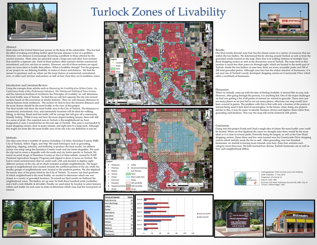
Zones of Livability:
Most cities of the United States have grown on the basis of the automobile. This has had the effect of making everything farther apart because distance is less of a problem. However, now distance is increasingly becoming a problem to those affected by the current economy. Most cities are sprawled across a large area and often have sections that could be a separate city. Each of these sections often contains similar commercial, recreational, and civic services or centers. However, not all of these sections are equal; some are more ideal or livable than others. What is livability though? For the purposes of our project we are defining livability in terms of choice and distance. We find the answer to questions such as, where are the most choices of commercial, recreational, civic, or other such services and centers; as well as how close they are to residence zones.
Most cities of the United States have grown on the basis of the automobile. This has had the effect of making everything farther apart because distance is less of a problem. However, now distance is increasingly becoming a problem to those affected by the current economy. Most cities are sprawled across a large area and often have sections that could be a separate city. Each of these sections often contains similar commercial, recreational, and civic services or centers. However, not all of these sections are equal; some are more ideal or livable than others. What is livability though? For the purposes of our project we are defining livability in terms of choice and distance. We find the answer to questions such as, where are the most choices of commercial, recreational, civic, or other such services and centers; as well as how close they are to residence zones.
67th Annual California Geographical Society Conference
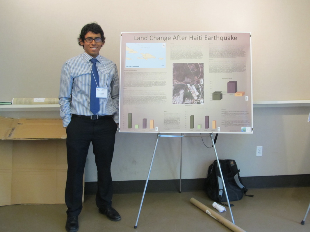
Davis, CA - 2012
Land Change After Haiti Earthquake:
On Tuesday, 12 January 2010, at 16:53 local time, a 7.0 magnitude earthquake struck Haiti (fig A). The nation of Haiti is very poor and thus suffered greatly from the earthquake. It has been over a year since the earthquake and the nation is still seeing very few visible signs of reconstruction. Port-au-Prince was hit extremely hard due to how close the earthquake was and to the large number of people living there in the capital. In this study, we used the Google Earth 'Show Historical Imagery' button to compare the land cover type from before the earthquake to today, focusing on green-space, agriculture, buildings, and roads/dirt. The major changes that we found throughout the landscape were the green space coverage and the building coverage. Green space has given way to buildings. Most of these buildings are shelters that have been built to protect those that have lost their homes in the earthquake. Haiti was already struggling with massive deforestation and a bad economy before the earthquake hit (Malik 2001). Now that the earthquake has destroyed so many of its homes and buildings, the people of Haiti are struggling just to survive.
On Tuesday, 12 January 2010, at 16:53 local time, a 7.0 magnitude earthquake struck Haiti (fig A). The nation of Haiti is very poor and thus suffered greatly from the earthquake. It has been over a year since the earthquake and the nation is still seeing very few visible signs of reconstruction. Port-au-Prince was hit extremely hard due to how close the earthquake was and to the large number of people living there in the capital. In this study, we used the Google Earth 'Show Historical Imagery' button to compare the land cover type from before the earthquake to today, focusing on green-space, agriculture, buildings, and roads/dirt. The major changes that we found throughout the landscape were the green space coverage and the building coverage. Green space has given way to buildings. Most of these buildings are shelters that have been built to protect those that have lost their homes in the earthquake. Haiti was already struggling with massive deforestation and a bad economy before the earthquake hit (Malik 2001). Now that the earthquake has destroyed so many of its homes and buildings, the people of Haiti are struggling just to survive.
65th Annual California Geographical Society Conference
Bishop, CA - 2011
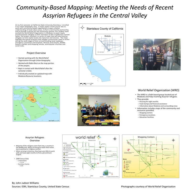
Community-Based Mapping:
World Relief Organization (WRO) is a faith based group, that helps Assyrian refugees, from outside the United States, settle into their new homes. I started working with the WRO during Urban Geography, fall 2010. After fall semester, it transformed into an independent studies project. Once finished with independent studies, the project also became my 2011 California Geographical Society presentation. The poster shows where Assyrian refugees are emigrating from and why they moving to the Central Valley.
For more information on the independent studies project, please visit Portfolios>Additional Project>Independent Studies - /
Independent Studies Project
World Relief Organization
Modesto, CA
World Relief of Modesto:
During the CSU Stanislaus spring 2011 semester, I expanded the Cartography/Urban Geography project, into independent study course credits. After showing the six maps to the World Relief Organization, they asked for a single more detailed map. A list of addresses, provided by WRO, were geocoded and uploaded to new map. Points such as restaurants, health services, and community resources were placed on the map. Only selected roads were used from previous maps. If there was no point near a smaller road, it was taken out. The color schemes were changed from white to yellow, to be more visually balanced.
Once the map was complete and printed out, I dropped it off at the World Relief office. It is now hanging on their wall, in the conference room. In addition to using the map during meetings, they are able to print out smaller versions and pass them out to refugees.
For more information about the World Relief Organization in Modesto, please visit their website. - http://worldreliefmodesto.org/
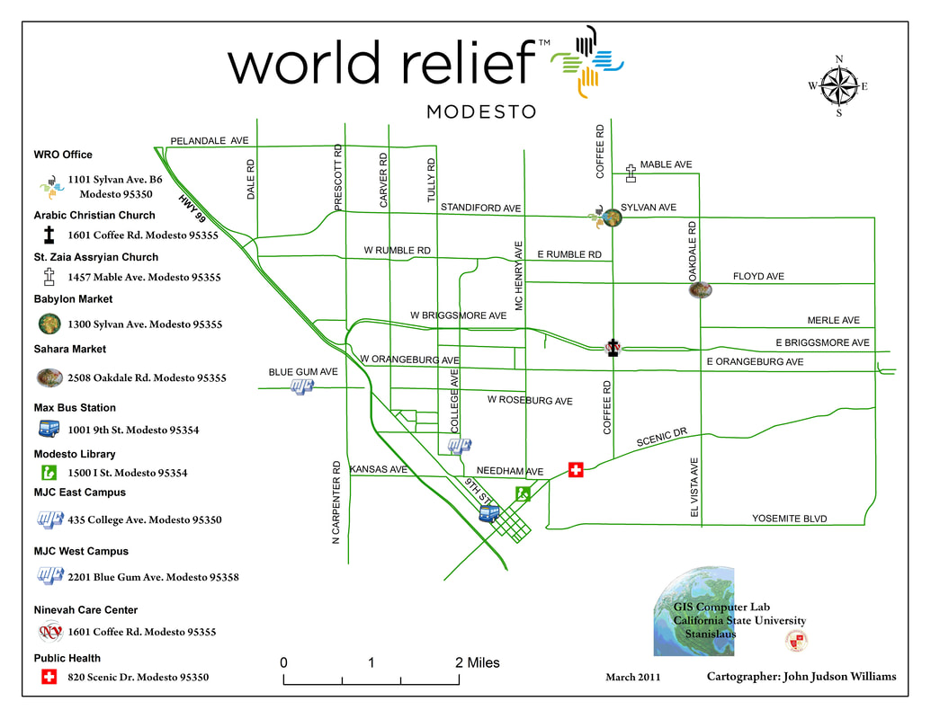
Points on map include: WRO office, two Assyrian restaurants, and both Modesto Junior College campuses
